It's Wednesday June 24, 2026![]() Dock Quote: “Anger is an...
Dock Quote: “Anger is an...
News From The Village Updated Almost Daily


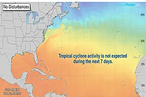
Oriental NC Weather Forecast
| Oriental, North Carolina (28571) | Lat: 35.02N, Lon: 76.7W |
| Current Conditions From The Oriental Weather Station | ||
| Updated 9:46pm on 6/24/26: 74 F | ||
 | Today's Hi: 82 F at 2:39pm Today's Lo: 64 F at 6:04am Heat Index (feels like): F | Humidity: 69% Dewpoint: 63 F Barometer: 30.02in Steady |
| Wind Speed: 2mph S Gusts: 4mph | Today's Hi Wind: 14mph at 12:00am Yesterday's Hi Wind: 36mph at 3:05pm | |
| Hourly rain rate: 0.000 in Rain Today: 0.00 in | Rain Yesterday: Rain This Month: 2.90in | |
| Click here for more detailed information from The Oriental Weather Station | ||||||||||||||||||||||||||||
| Current Conditions at nearby location: Cherry Point, Marine Corps Air Station, NC Updated: 855 PM EDT WED JUN 24 2026 | ||||||||||||||||||||||||||||
|
| |||||||||||||||||||||||||||


|
| TONIGHT | THURSDAY | FRIDAY | SATURDAY | SUNDAY | MONDAY | TUESDAY |
 |  | |  | | | |
| Mostly Clear | Sunny | Sunny | Partly Sunny | Mostly Sunny | Mostly Sunny | Sunny |
| Lo: 69°F | Hi: 89°F Lo: 71°F | Hi: 91°F Lo: 79°F | Hi: 95°F Lo: 75°F | Hi: 91°F Lo: 71°F | Hi: 89°F Lo: 71°F | Hi: 89°F Lo: 71°F |
| Precip: 20% | Precip: 50% | Precip: 70% |
| Weather Forecast In Detail: Forecast Issued: 755 PM EDT Wed Jun 24 2026 |
| Tonight...Mostly clear. Lows in the upper 60s. Southeast winds 5 to 10 mph. Thursday...Sunny. Highs in the upper 80s. East winds 5 to 10 mph. Thursday Night...Partly cloudy in the evening, then becoming mostly clear. Lows in the lower 70s. Southeast winds 5 to 10 mph, becoming south after midnight. Friday...Sunny. A slight chance of showers and thunderstorms in the afternoon. Highs in the lower 90s. Southwest winds around 5 mph, increasing to south 10 to 15 mph in the afternoon. Chance of rain 20 percent. Friday Night...A slight chance of thunderstorms in the evening. Partly cloudy with a slight chance of showers. Lows in the upper 70s. Southwest winds 10 to 15 mph. Chance of rain 20 percent. Saturday...Partly sunny. A chance of showers and thunderstorms in the afternoon. Highs in the mid 90s. Chance of rain 50 percent. Heat index values up to 110. Saturday Night...Mostly cloudy in the evening, then becoming partly cloudy. A chance of showers and thunderstorms. Lows in the mid 70s. Chance of rain 50 percent. Heat index values up to 110 early in the evening. Sunday...Mostly sunny. Showers and thunderstorms likely in the afternoon. Highs in the lower 90s. Chance of rain 70 percent. Heat index values up to 110. Sunday Night...Mostly cloudy with showers and thunderstorms likely in the evening, then partly cloudy with a chance of showers and thunderstorms after midnight. Lows in the lower 70s. Chance of rain 70 percent. Heat index values up to 100 early in the evening. Monday...Mostly sunny. Highs in the upper 80s. Monday Night...Mostly clear. Lows in the lower 70s. Tuesday...Sunny. Highs in the upper 80s. Tuesday Night...Clear. Lows in the lower 70s. Wednesday...Sunny. Highs in the lower 90s. Heat index values up to 105. |