BULLETIN
Tropical Storm Edouard Intermediate Advisory Number 3A
NWS National Hurricane Center Miami FL       AL052026
100 AM CDT Tue Sep 01 2026

...EDOUARD EXPECTED TO STRENGTHEN BEFORE REACHING THE NORTHWEST
GULF COAST LATER TODAY...

SUMMARY OF 100 AM CDT...0600 UTC...INFORMATION
----------------------------------------------
LOCATION...28.8N 92.5W
ABOUT 85 MI...135 KM SE OF CAMERON LOUISIANA
ABOUT 115 MI...185 KM SE OF PORT ARTHUR TEXAS
MAXIMUM SUSTAINED WINDS...40 MPH...65 KM/H
PRESENT MOVEMENT...WNW OR 300 DEGREES AT 7 MPH...11 KM/H
MINIMUM CENTRAL PRESSURE...1005 MB...29.68 INCHES

WATCHES AND WARNINGS
--------------------
CHANGES WITH THIS ADVISORY:

None.

SUMMARY OF WATCHES AND WARNINGS IN EFFECT:

A Storm Surge Warning is in effect for...
* High Island to the Vermilion/Cameron Parish Line

A Hurricane Watch is in effect for...
* High Island to the Cameron Louisiana

A Tropical Storm Warning is in effect for...
* Port Bolivar to the  Vermilion/Iberia Parish Line

A Storm Surge Warning means there is a danger of life-threatening
inundation, from rising water moving inland from the coastline,
during the next 24 hours in the indicated locations. For a
depiction of areas at risk, please see the National Weather
Service Storm Surge Watch/Warning Graphic, available at
hurricanes.gov.  This is a life-threatening situation.  Persons
located within these areas should take all necessary actions to
protect life and property from rising water and the potential for
other dangerous conditions.  Promptly follow evacuation and other
instructions from local officials.

A Hurricane Watch means that hurricane conditions are possible
within the watch area, in this case within the next 24 hours.

A Tropical Storm Warning means that tropical storm conditions are
expected somewhere within the warning area, in this case within the
next 12 to 24 hours.

For storm information specific to your area, including possible
inland watches and warnings, please monitor products issued by your
local National Weather Service forecast office.

DISCUSSION AND OUTLOOK
----------------------
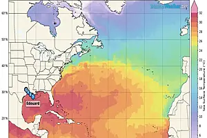
At 100 AM CDT (0600 UTC), the center of Tropical Storm Edouard was
located by Air Force Reserve reconnaissance aircraft near latitude
28.8 North, longitude 92.5 West. Edouard is moving toward the
west-northwest near 7 mph (11 km/h). A west-northwestward to
northwestward motion is forecast during the next day or two.  On the
forecast track, the center of Edouard is predicted to reach the
northwestern Gulf Coast within the warning area later today and move
inland over southeast Texas tonight.

Maximum sustained winds remain near 40 mph (65 km/h) with higher
gusts. Strengthening is forecast and Edouard could approach
hurricane strength before it reaches the northwest Gulf coast later
today. Rapid weakening is expected after the center moves inland.

Tropical-storm-force winds extend outward up to 25 miles (35 km)
from the center.

The minimum central pressure estimated by reconnaissance dropsonde
data is 1005 mb (29.68 inches).

HAZARDS AFFECTING LAND
----------------------
Key messages for Tropical Storm Edouard can be found in the
Tropical Cyclone Discussion under AWIPS header MIATCDAT5 and WMO
header WTNT45 KNHC.

WIND: Tropical storm conditions are expected to reach the coast
within the warning area later this morning.  Hurricane conditions
are possible within the Hurricane Watch area later today.

STORM SURGE: The combination of storm surge and tide will cause
normally dry areas near the coast to be flooded by rising waters
moving inland from the shoreline. The water could reach the
following heights above ground somewhere in the indicated areas if
the peak surge occurs at the time of high tide...

High Island, TX to Vermilion/Cameron Parish Line, LA...3-5 ft
Vermilion/Cameron Parish Line, LA to Morgan City, LA...1-3 ft

The deepest water will occur along the immediate coast near and to
the right of the center. Surge-related flooding depends on the
relative timing of the surge and the tidal cycle, and can vary
greatly over short distances. For information specific to your
area, please see products issued by your local National Weather
Service forecast office.

For a complete depiction of areas at risk of storm surge inundation,
please see the National Weather Service Peak Storm Surge Graphic,
available at hurricanes.gov/graphics_at5.shtml?peakSurge.

RAINFALL: Edouard is expected to produce rainfall totals of 3 to 6
inches with maximum totals up to 9 inches for parts of the Upper
Texas Coast inland through east-central Texas, with potential for 2
to 3 inches in far southwest Louisiana. This rainfall is likely to
produce flash flooding, especially in low-lying and urban areas.
River flooding may also be possible.

For a complete depiction of forecast rainfall associated with
Edouard, please see the National Weather Service Storm Total
Rainfall Graphic available at
hurricanes.gov/graphics_at5.shtml?rainqpf and the Flash Flood Risk
graphic at hurricanes.gov/graphics_at5.shtml?ero.

NEXT ADVISORY
-------------
Next complete advisory at 400 AM CDT.

$$
Forecaster Papin |

 Dock Quote: “For whatever we...