It's Friday September 25, 2026 Dock Quote: “Towns are like...
News From The Village Updated Almost Daily


Tropical Storm Gonzalo Forecaster's Discussion & Computer Models
|
||||||||||||||
Tropical Storm Gonzalo Forecaster's Discussion # |
| A graphic showing several computer modeled projected tracks is at the bottom of this page. |
Tropical Storm Gonzalo Discussion Number 4 NWS National Hurricane Center Miami FL AL072026 800 PM CVT Fri Sep 25 2026 The overall structure of Gonzalo has changed little today. The circulation is elongated from the north-northeast to south-southwest with the advisory position set as a mean between a couple of low-level vorticity centers on either end of the elongated center. Deep convection remains displaced well to the northeast of the estimated center due to moderate to strong southwesterly shear. Objective and subjective satellite intensity estimates have not changed much, therefore the initial intensity remains 45 kt, in line with the earlier scatterometer data. Gonzalo has been moving more northward today with an initial motion estimate of 350/10 kt. The storm is expected to be steered northward to north-northwestward during the next couple of days between a mid-level trough to its north and a ridge over western Africa. Gonzalo's forward speed is expected to decrease as the system becomes increasingly shallow and is steered by the weaker low-level flow. The new official track forecast is similar to the previous advisory and lies closest to the latest Google Deep Mind ensemble prediction. The vertical shear over Gonzalo is forecast to increase significantly on Saturday and with gradually decreasing sea surface temperatures along the forecast track, weakening should begin by Saturday morning. Simulated satellite imagery from the global models indicate that Gonzalo will lose organized deep convection in 24 to 36 hours, and the new NHC forecast shows the system becoming a post-tropical remnant low by Sunday morning. The intensity forecast is in best agreement with the typically reliable consensus aids. Key Messages: 1. Tropical storm conditions will continue across portions of the Cabo Verde Islands tonight. 2. Heavy rains from Gonzalo could affect the eastern portions of the Cabo Verde Islands and the western coast of Africa between Guinea-Bissau to Senegal through Saturday. Areas of flash flooding will be possible along the Africa coast with some isolated flash flood concerns for the eastern islands of Cabo Verde. FORECAST POSITIONS AND MAX WINDS INIT 25/2100Z 16.2N 22.7W 45 KT 50 MPH 12H 26/0600Z 17.6N 22.9W 45 KT 50 MPH 24H 26/1800Z 19.0N 23.3W 35 KT 40 MPH 36H 27/0600Z 20.0N 23.5W 30 KT 35 MPH...POST-TROP/REMNT LOW 48H 27/1800Z 20.6N 23.9W 25 KT 30 MPH...POST-TROP/REMNT LOW 60H 28/0600Z 21.2N 24.3W 20 KT 25 MPH...POST-TROP/REMNT LOW 72H 28/1800Z 21.7N 24.6W 20 KT 25 MPH...POST-TROP/REMNT LOW 96H 29/1800Z 22.0N 25.0W 20 KT 25 MPH...POST-TROP/REMNT LOW 120H 30/1800Z...DISSIPATED $$ Forecaster Brown |
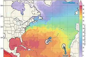
The Forecaster's Discussion above often refers to several computer models. The graphic below includes multiple projected paths, showing what the different computer models indicate. The black line is the NHC (National Hurricane Center) path. This graphic is not an official NHC product. For the official NHC projected path of Tropical Storm Gonzalo click here.

click image for a larger view
For more information about tropical storm computer models click here.